« Back to Picture and Video Gallery Page
Computer Instruction at St. Christina School - Pictures
Year 2011- 2012
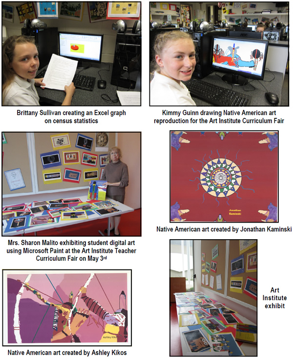
Students in grades 3 to 8 have been working on Excel graphs using information from the Census government site and CIA Factbook as part of the history and geography theme for the year. Statistics from these sites have been used to create line, bar, column, doughnut, area, scatter, surface, bubble, radar, and pie graphs. Information about starvation, protective shelter, literacy, gender, languages, and religions of the world was found on the site “100 People: A World Portrait,” and used in various graphs. Word art for titles on the graphs, coloring columns for effect, and adding clip art also were part of the lesson in changing a spreadsheet into a graph.
Our Native American Indian art was displayed at the Art Institute at the Teacher Curriculum Fair on May 3rd. Our students used Microsoft Paint to mix colors, manage brushes, use the spray can and paint bucket to add color and texture, add a text box with a certain font and size, and use tools to create a perfect line or shape.
To practice building a concept map and do research on our themes of history and geography, students designed the map called Money Around the World; types of foreign currency were found on the website “Federal Reserve Bank of Cleveland.”
Another website that has much to offer a student who wants to learn interesting topics in depth is the Smithsonian website. A paleontologist can tell temperatures from a sudden global warming of the Earth 55 million years ago by reading the tree leaves in the lesson called “Prehistoric Climate Change and Why It Matters Today.” Videos, interactive games, and tests teach students how to use a mathematical equation to examine leaf edges and tell temperatures of a time when animals were looking for cooler areas of the world to inhabit. Another Smithsonian interactive lesson is “Sizing Up the Universe,” which asks the question, “If the Earth is the size of a Brussels sprout, how big is the sun?” In this interactive challenge on astronomy, you can guess relative sizes in outer space and then do the math to check your answers. Students who have finished 25 lessons of keyboarding are working on these lessons.
The site AirPano takes students to parts of the world with one click and gives them panoramic views of the area and also four kinds of maps on places like the Church of the Intercession of the Virgin on the Nerl River in Russia. Students experiment with road, satellite, hybrid, and terrain maps and also the zoom and directional features. Even firstgraders are able to move around faraway castles in Germany with ease!
The website called “Chicago Historical Society: My Chicago” is an interactive site where students can learn about the Chicago flag and its symbols, the skyline, Chicago’s World Fairs, The Great Chicago Fire, the Chicago River, and then use the “Refrigerator Poetry” segment to write poems about Chicago.
Puzzles and quizzes on the National Geographic Kids website allows students to put together puzzles of a peacock’s tail or a gecko’s eye. Great for mouse control for the primary students! “Quiz Your Noodle” is fantastic for learning interesting facts on everything from giraffes to women of the ancient world. Great for summertime learning - educational and fun!

|
